Cape Cod Pictures
Myriads of scenic Cape Cod pictures are yours for the taking when you cross over one of two bridges, Bourne or Sagamore, to enter this very special island where the pilgrims first landed.
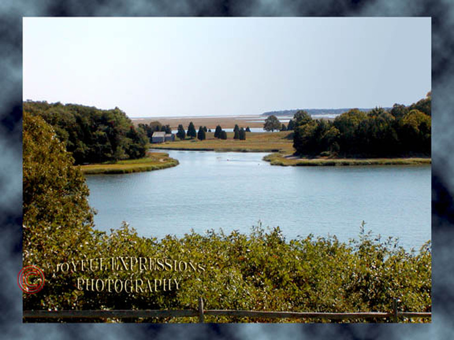
Upper CapeSandwichThe town of Sandwich is the gateway to the Upper Cape. Sandwich is a town of historic homes including the oldest house on the Cape. The Sandwich marsh exudes tranquility and beauty. The boardwalk to Cape Cod Bay and the beach is a favorite of tourists and natives alike.
|
|
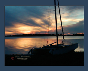
Sunset on the Cape Cod Canal
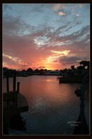
The only land route to Cape Cod is via the man-made canal. It's a beautiful entry with breath-taking views,
especially at sunset.
Why is the Cape described as upper and lower?
Cape Cod resembles an arm with the Upper Cape as the shoulder,
and the Lower Cape as its forearm and hand.
The 1000 foot Sandwich Boardwalk (to the right) crosses the marsh and Mill Creek. It leads to steps to a bench at the top of a dune overlooking Sandwich Beach with a view toward Plymouth. Another flight of stairs leads down to the beach itself (below). That's me on the boardwalk!
|
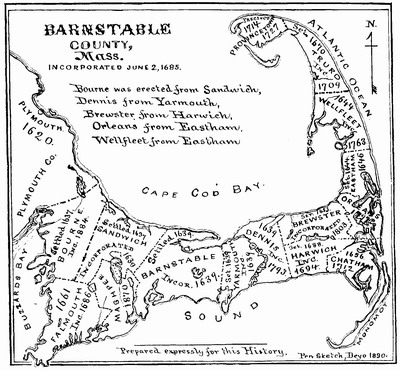
This 1890 map of Cape Cod, Massachusetts displays town boundaries that are the same today.
Construction of a canal began in 1909, and was completed in 1916. In 1935 widening to 480 feet, and dredging to 32 feet began. The improvements were completed in 1940, and remain essentially the same today. This effectively made Cape Cod an island breached by two bridges, the Sagamore, accessing Sandwich at the northern end, and the Bourne, accessing Falmouth in the south. 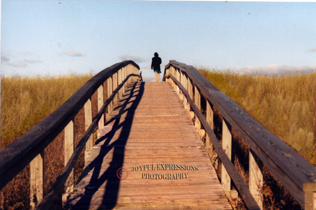
|
The first beach over the Bourne Bridge...
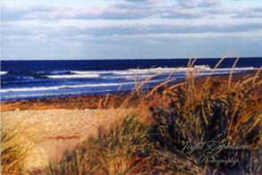
Sandwich Beach
Although Florida is our home now, I lived on the Cape for almost 20 years including 5 years after Tom and I married. My daughter and many friends still live on the Cape. We visit as often as possible, and take as many scenic Cape Cod pictures as possible!
Falmouth & Woods Hole
The town of Falmouth is located to the south of Sandwich, and is home for the Woods Hole Oceanographic Institution famous for exploring the ruins of the Titanic.
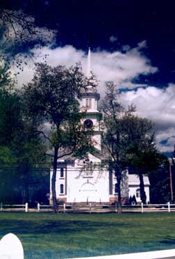
Like Sandwich, Falmouth is the site of many historic homes and churches. The picture on the right is the lovely Falmouth Green. Located in Woods Hole, the Nobska Light is the only one of the Cape Cod lighthouses on the Upper Cape east of the bridges. 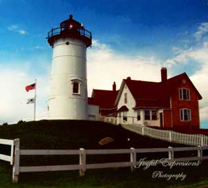
Falmouth is a seafaring town with many beautiful beaches and sheltered harbors.
As photographers, our most difficult decision was deciding which Cape Cod pictures to take and then which ones to keep! |
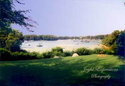
A Falmouth Harbor
|
As the first part of North America to be permanently settled by Europeans, Cape Cod history is intimately connected with the roots of the first settlers. Many Cape towns were named after British towns. Falmouth, Massachusetts is twinned with Falmouth, England which we visited on our 10th anniversary.
Mid Cape
Brewster
Breakwater Beach in Brewster on Cape Cod Bay was my favorite of the many Cape Cod Cod beaches during the years I lived in Brewster on the Mid-Cape.
Yarmouth & Dennis
Cape Cod cranberries are known and shipped world wide. This cranberry bog was right down the street from our home in Yarmouth, and we loved walking around the bogs, especially during harvest.
|
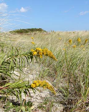
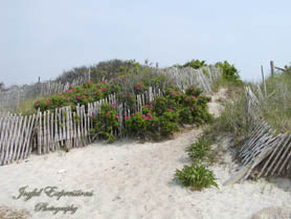
Among my favorite Cape Cod pictures are Rosa Rugosa.Originally natives of Asia, these lovely flowers festoon the Cape from the Upper Cape to the Lower Cape. I'm guessing they found their way to Cape Cod via the fishing and whaling industry of the seventeen and eighteen hundreds.
The storm fences are to help protect the fragile dunes during the storms of winter. Rosa Rugosa lens a quaint charm to the scene. 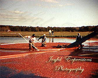
|
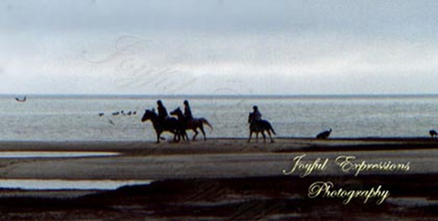
Low tide at a beach along Cape Cod Bay
made room for this silhouette of frisky horses and their young riders.
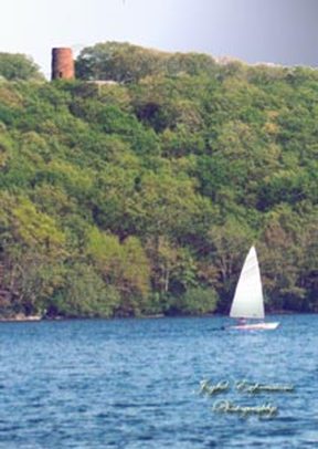
Rising above lovely Scargo Lake in Dennis, the top of Scargo Tower
offers spectacular Cape Cod pictures of the lake and all the way to Cape Cod Bay.
offers spectacular Cape Cod pictures of the lake and all the way to Cape Cod Bay.
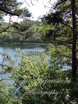
It is said that Cape Cod has a pond for every day of the year, and I think that is probably true. We lived on one.
|
If there was a breeze anywhere, we had one from the deck of our Yarmouth home. Our view of Half Way Pond was always peaceful and relaxing.
|
Paine's Creek Snowed-In
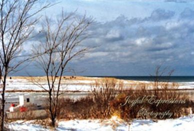
There are still lots of beautiful Cape Cod pictures that can be taken in the winter: frozen wave curls on Cape Cod Bay, boats marooned in ice like this one on Paine's Creek in Dennis, pines covered in a snow blanket..
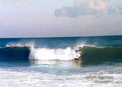
The Lower Cape is Best Know for its Magnificent Beaches!